
定額
イラスト素材: African Great Lakes regional political map. Administrative divisions of Uganda, Rwanda, Burundi, Tanzania, Kenya Vector map isolated on white background with flags and country name labels.
素材番号 : 143301479 全て表示
African Great Lakes regional political map....[143301479]のイラスト素材は、ウガンダ、タンザニア、ベクトルのタグが含まれています。この素材はpytyczechさん(No.332278)の作品です。SサイズからXLサイズまで、¥550からご購入いただけます。無料の会員登録で、カンプ画像のダウンロードや画質の確認、検討中リストをご利用いただけます。 全て表示
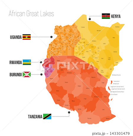
African Great Lakes regional political map. Administrative divisions of Uganda, Rwanda, Burundi, Tanzania, Kenya Vector map isolated on white background with flags and country name labels.
拡大・縮小
※ 画像をドラッグすることで移動させることができます


クレジット(作者名表記) : pytyczech / PIXTA(ピクスタ)
この素材についてもっと見る
- 被写体の権利確認について詳しくはこちら
- アクセス : 7
- 過去の購入 : なし
- この素材についてクリエイターへ問い合わせる
- 販売に不適切な素材として報告