
定額
イラスト素材: State of Kansas, subdivided into 105 counties, political map with borders and county names. State in the Midwestern region of the United States, nicknamed The Sunflower State, and The Wheat State.
素材番号 : 127607969 全て表示
State of Kansas, subdivided into 105 counties,...[127607969]のイラスト素材は、マップ、米国、ベクトルのタグが含まれています。この素材はPeter Hermes Furianさん(No.362672)の作品です。SサイズからXLサイズ、ベクター素材まで、¥550からご購入いただけます。無料の会員登録で、カンプ画像のダウンロードや画質の確認、検討中リストをご利用いただけます。 全て表示
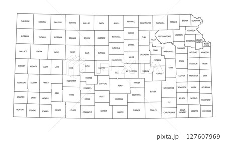
State of Kansas, subdivided into 105 counties, political map with borders and county names. State in the Midwestern region of the United States, nicknamed The Sunflower State, and The Wheat State.
拡大・縮小
※ 画像をドラッグすることで移動させることができます


クレジット(作者名表記) : Peter Hermes Furian / PIXTA(ピクスタ)
この素材についてもっと見る
- 被写体の権利確認について詳しくはこちら
- アクセス : 82
- 過去の購入 : なし
- この素材についてクリエイターへ問い合わせる
- 販売に不適切な素材として報告